U4 to Grasbrook: What the 13 October hearing means
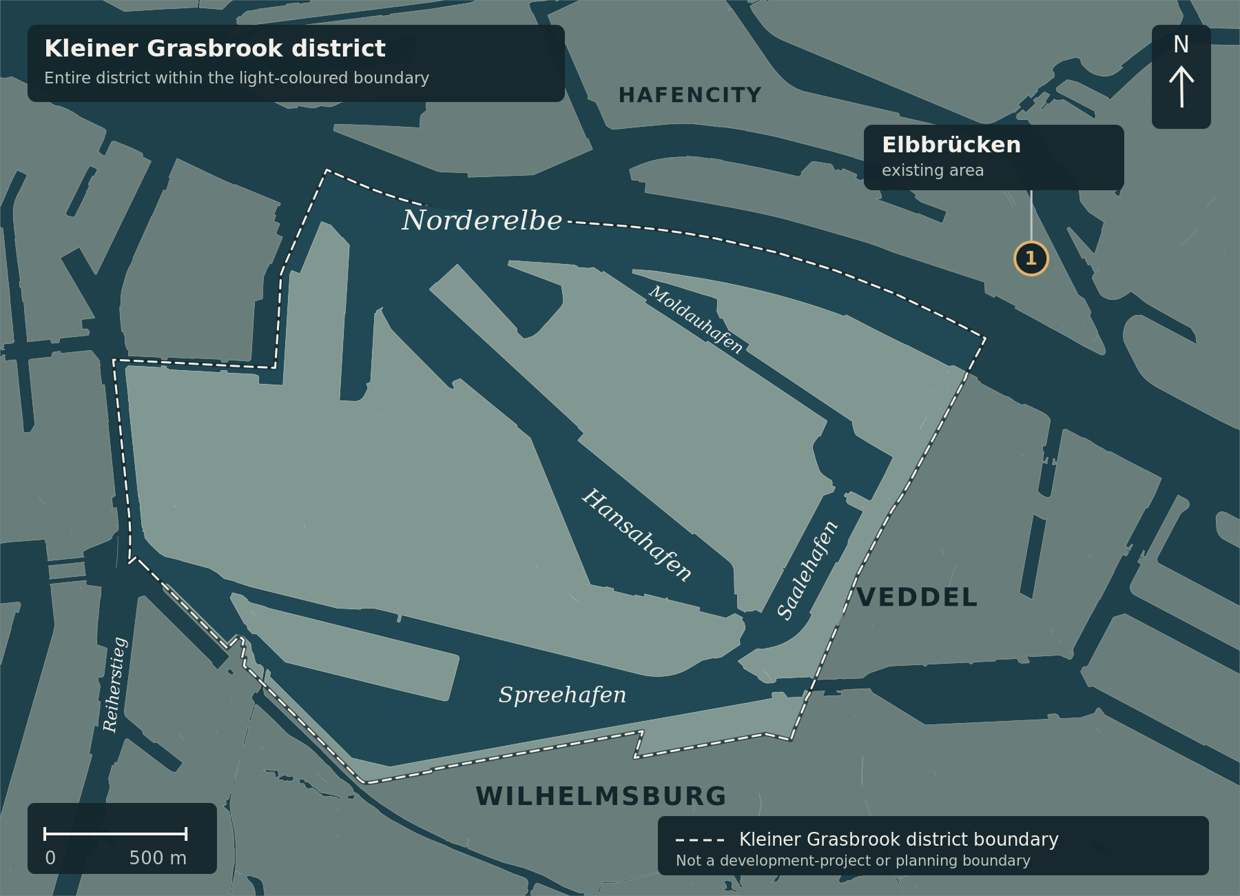
The map provides geographical context for Kleiner Grasbrook, Moldauhafen and the existing Elbbrücken area (1, approximate orientation point). The light dashed line is the district boundary, not the U4 project boundary. No new U4 alignment, precise future station location or hearing venue at Herrengraben is shown. The short light line at the marker only connects its point and label.
The planned U4 extension to Grasbrook has a new date in its approval process: from Tuesday, 13 October 2026, objections and comments will be discussed at a formal hearing. The authority has announced the hearing; this does not mean that the project has received approval. Q1 · Q5
Why it also matters for Veddel
The U4 is intended to continue from its current terminus at Elbbrücken, crossing the Norderelbe on a new bridge before following an elevated viaduct to the proposed Moldauhafen station. The station would sit above the harbour basin, with a separate level beneath the tracks for pedestrians and cyclists. The planned Veddeler Brücke is also intended to provide access to the U4 from northern Veddel. The connection is therefore relevant not only to people who may eventually live in the new Grasbrook development. Q3
What will be discussed
Following objections and comments, HOCHBAHN revised its documents. The amended plans were displayed again from 6 July to 5 August 2026. The authority lists changes to the assessment of alternatives, environmental documents, drainage arrangements and construction sequencing, among other matters. The hearing is for discussion of objections and comments submitted on time about the original plan and its amendments. Q1
Not a public information evening
Proceedings begin at 10 am on 13 October, in seminar room 2 of the Katholische Akademie, Herrengraben 4, 20459 Hamburg. They may continue on subsequent days. The hearing is not open to the general public: it is for participants in the procedure, including affected parties and people who lodged objections. It is not an invitation for anyone interested in the project to attend. Participants need photo identification; an authorised representative requires written authorisation. Q2
A step towards a decision, not towards boarding a train
The approval procedure examines the public and private interests affected by the project and weighs them against one another. HOCHBAHN gives 7 September 2026, now passed, as the deadline for comments on the amended plans. The newly announced hearing does not open another general round for submitting objections. Q4 · Q1
A separate decision by the authority, the Planfeststellungsbeschluss, determines whether the project is admissible. The hearing notice establishes neither that decision nor the start of construction. For neighbours, the important questions remain which solutions and conditions will ultimately be adopted, including how the effects of construction and subsequent operation will be addressed. Q5
Quellenstand / Sources checked: 6. Oktober / October 2026.
Map attribution: Cartography: ChatGPT for kleiner-grasbrook.net, 6 October 2026. Base: unchanged V0.5 geometry from the approved Moldauhafen R9 originals. Land/water: Free and Hanseatic City of Hamburg, State Agency for Geoinformation and Surveying (LGV), ALKIS simplified, adapted; grasbrook-alkis-2026-09-22-v1, retrieved on 22 September 2026 according to the stored manifest. Administrative boundary: LGV, ALKIS administrative boundaries Hamburg, district 117, layer app_stadtteile_EPSG_25832.json from the archive supplied on 4 October 2026; no uniform survey date is specified. Both datasets: Data Licence Germany – Attribution 2.0. Adaptation: Nachtatlas styling, dimmed surroundings, boundary gaps beneath water labels; Elbbrücken orientation point added. Its position is the existing editorial area anchor in src/news-map.js at the stated commit, not a surveyed station coordinate. This is not a construction-progress, alignment or approval map.
ALKIS · Verwaltungsgrenzen / Administrative boundaries · Lizenz / Licence