Red Storm Charlie: Exercise at O’Swaldkai and Information for Residents
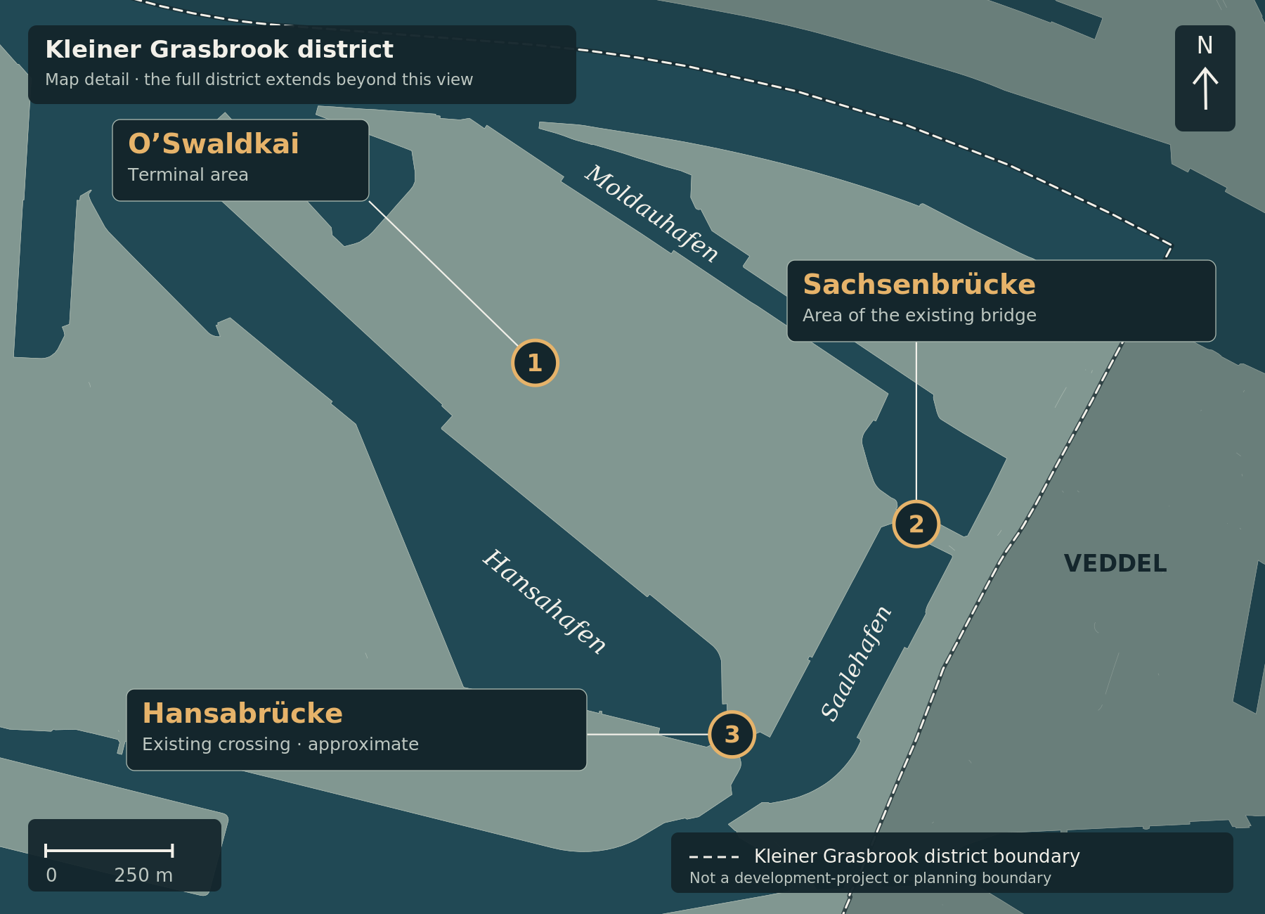
Marker 1 identifies the existing O’Swaldkai terminal area. Sachsenbrücke (2) and Hansabrücke (3, approximate location) are included solely for geographical orientation. Exercise locations within the terminal, movements, restricted areas and operational routes are not shown. The light dashed line marks the Kleiner Grasbrook district boundary, not a project or closure boundary. The light connector lines link labels and markers; they are not routes.
Map correction, 5 October 2026: The orientation map and its explanation have been updated. The original article text and its subject-matter source review date remain unchanged.
At O’Swaldkai on Kleiner Grasbrook, the Bundeswehr and police rehearsed a response to a drone attack on a military convoy on 24 September 2026. According to the dpa report published by Radio Hamburg, this formed part of the opening of Red Storm Charlie. It was an exercise scenario, not an actual attack. Report on the start of the exercise.
The Hamburg-wide exercise runs from 24 to 26 September, led by the Hamburg State Command. Around 500 service personnel are training with civilian authorities, emergency organisations and companies. The Bundeswehr says the purpose is to improve cooperation and coordination in crisis situations. Bundeswehr: programme and background.
Why O’Swaldkai is involved
O’Swaldkai is an existing port location. UNIKAI operates a terminal there at Dessauer Straße 10 / Shed 48. The map provides orientation around this area without marking the precise exercise site. UNIKAI: location.
The fictional overall scenario involves allied troops arriving in Hamburg with their equipment before being moved eastward. The port is a focus because of its transport and logistics infrastructure. This describes the exercise’s assumed sequence of events, not an actual state of defence. The City of Hamburg’s explanation.
Information for residents
The environmental authority has announced increased helicopter noise. Under the published schedule, flights on Friday 25 September and Saturday 26 September are planned during daylight hours. The flights planned until around midnight concerned Thursday. Official helicopter-noise notice.
Vehicle movements should be distinguished from this flight schedule: the police and city also warn of night-time convoys and temporary traffic disruption. The general notices reviewed do not establish specific road closures on Kleiner Grasbrook. Hamburg Police and the city’s traffic information.
For questions and complaints about military flight operations, the environmental authority lists the public information service at 0800 8620730 and FLIZ@bundeswehr.org. Contact details in the noise notice.
Protests are also taking place
There are also protests against the exercise and arms transports through the port. On 25 September, NDR reported a railway blockade in Moorburg, among other events. That location is not at O’Swaldkai and should not be confused with the local exercise site. NDR: the exercise and protests.
Cartography: ChatGPT for kleiner-grasbrook.net, 4 October 2026 (unchanged V0.5 image). Land, water and administrative boundary: Free and Hanseatic City of Hamburg, State Agency for Geoinformation and Surveying (LGV), ALKIS simplified and ALKIS administrative boundaries Hamburg, adapted; Data Licence Germany – Attribution 2.0. Land/water base grasbrook-alkis-2026-09-22-v1, EPSG:25832; retrieval recorded in the manifest: 22 September 2026, with individual record dates up to 16 September 2026. District boundary 117 from the GeoJSON archive supplied by Thomas on 4 October 2026, layer app_stadtteile_EPSG_25832.json. No uniform survey date; upload and image dates do not establish current construction progress. The administrative boundary is not the Grasbrook development-project boundary. O’Swaldkai and Sachsenbrücke: OpenStreetMap contributors, ODbL, via the Mapcarta records documented in V0.5. Hansabrücke: unchanged approximate editorial area anchor from the officially labelled aerial map of 14 February 2025, not a surveyed bridge centre. No operational data.
- Radio Hamburg / dpa – Exercise starts at O’Swaldkai
- Bundeswehr – Red Storm Charlie: background and FAQ
- Hamburg Senate Chancellery – Red Storm Charlie
- Hamburg environmental authority – Exercise and helicopter noise
- Hamburg Police – Information about the exercise
- NDR – Live blog: the exercise and protests
- UNIKAI – Contact and location
- UNIKAI – Terminal plan
- Hamburg LGV – Simplified ALKIS geographic data
- Data licence Germany – attribution 2.0