Wind as the Main Propulsion Source: What Windship Day on PEKING Explored
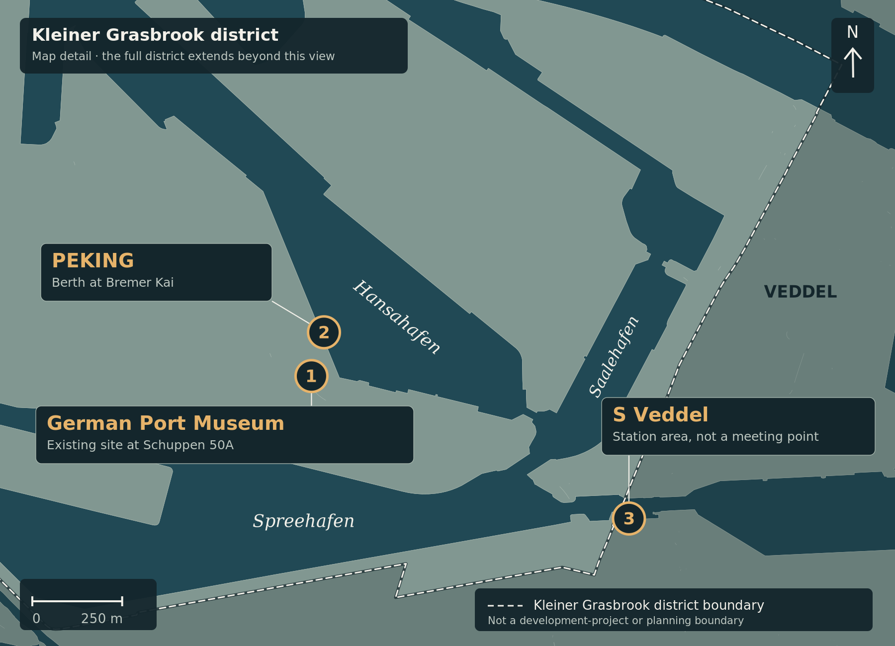
The map shows the existing museum site at Schuppen 50A (1), PEKING’s berth at Bremer Kai (2) and the S Veddel station area (3). The museum and ship have separate markers. No planned museum building, exact entrances or event route are shown.
On 31 August 2026, specialists gathered for Windship Day aboard PEKING at the existing port museum near Schuppen 50A. The event connected the historic sailing cargo ship with a current research question: how can wind once again supply most of a modern merchant ship’s propulsion? This article looks back at that event; it is not an invitation to an upcoming conference. Programme and venue · Museum announcement
More than auxiliary sails
Fraunhofer IWES’ report, published on 1 September, says that the RASANT research project was a main focus. It investigates cargo-ship concepts in which wind is intended to provide, on average, more than half of the required propulsion power. Renewable fuels, battery storage and hybrid propulsion systems are also part of the approach. IWES event report
That percentage is not a general promise to halve fuel consumption or emissions. It describes the intended wind contribution in the concepts being studied. Fully emission-free operation is a research objective; the event report does not demonstrate that performance for every ship or voyage. Context for the RASANT objectives
Commercial questions matter too
The programme covered ship design, route optimisation and propulsion-performance assessment, as well as the market conditions under which such ships could operate. Emden/Leer University of Applied Sciences leads the consortium, which includes Fraunhofer IWES, Flensburg University of Applied Sciences and MARIKO. Programme themes and research partners
On PEKING, port history meets shipping research
PEKING served as a venue and a historical reference point, not as a newly converted research vessel. The port museum describes its existing Schuppen 50A site, historic port facilities and the four-masted barque. This location is distinct from the additional museum building planned for Grasbrook. The port museum’s own description
For the neighbourhood, the event illustrates another role of the existing museum: alongside explaining port history, it provides a setting for discussion about shipping’s future. Whether and when individual research concepts enter a demonstrable regular commercial service remains a separate question.
Sources checked on 27 September 2026. The event date and the publication date of this retrospective are deliberately distinguished.
The orientation map and its explanation have been updated. The article’s subject-matter source review date remains unchanged.
Image credit: Cartography: ChatGPT for kleiner-grasbrook.net, 4 October 2026. Land and water: Free and Hanseatic City of Hamburg, State Agency for Geoinformation and Surveying (LGV), ALKIS simplified, adapted; stored basemap grasbrook-alkis-2026-09-22-v1, retrieved on 22 September 2026 according to the original manifest. Administrative boundary: LGV, ALKIS administrative boundaries Hamburg, district 117; from the GeoJSON archive uploaded by Thomas on 4 October 2026, layer app_stadtteile_EPSG_25832.json. Both datasets: Data Licence Germany – Attribution 2.0. Upload and ZIP timestamps are not survey or effective dates. This is not a record of current construction progress.
Additional points in the detail maps: O’Swaldkai, Sachsenbrücke, museum and PEKING from documented OpenStreetMap records via Mapcarta, OpenStreetMap contributors, ODbL. S Veddel from Wikidata Q7917951, CC0. Hansabrücke is an approximate editorial area anchor retained from V0.4, not a surveyed bridge centre. Point locations were not newly surveyed in this revision; inherited sources are documented in sources/places.json.
ALKIS vereinfacht · ALKIS Verwaltungsgrenzen Hamburg · Datenlizenz Deutschland / Data Licence Germany 2.0 · OpenStreetMap · Wikidata Q7917951