Explore Grasbrook on Foot: Guided Walks on 28 September
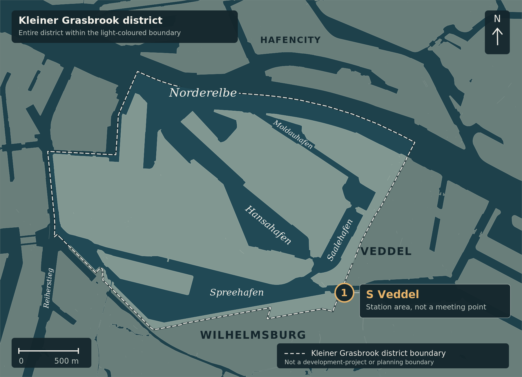
Orientation between Kleiner Grasbrook and Veddel. Marker 1 identifies the S Veddel station area, not the exact exit or meeting point. No tour route, museum destinations or planned buildings are shown. The light dashed line indicates the Kleiner Grasbrook district boundary, not a development-project or planning boundary.
Map correction, 5 October 2026: The orientation map and its explanation have been updated. The original article text and its subject-matter source review date remain unchanged.
On Monday, 28 September 2026, two public Grasbrook walks are announced as part of WATER_CITY WHERE NEXT?: 10 am to noon and 1 pm to 3 pm. The authority gives the meeting point as Veddel S-Bahn station, Am Gleise / Wilhelmsburger Platz exit. Bianca Penzlien and Andreas Schneider of HafenCity Hamburg GmbH are listed as guides. Official programme.
What the walk will cover
The walk starts in neighbouring Veddel and continues into the development area. Planned buildings, bridges and parks are to be presented. It therefore concerns future development rather than exclusively completed facilities. Grasbrook walk description.
The walk is not a new public consultation procedure. The most recently announced public consultation for the Kleiner Grasbrook 2 development plan ended on 2 September 2026. Consultation notice.
Registration and availability
Registration is required because capacity is limited. The authority links to the Guestoo registration page. The organiser’s registration information.
A visual check reported to the editorial team from 24 September 2026, approximately 1:18 pm CEST, recorded places available on both Grasbrook walks. According to the same reported display, registration for tours with remaining places is possible until 27 September 2026.
This is a dated snapshot, not a reservation or a guarantee of later availability. Check your preferred session in the current registration form; the organiser’s confirmation is what matters.
Finding your way
The map identifies the Veddel station area, not the exact exit or meeting point. Use the organiser’s location instructions above to find the group. No route is drawn; the description does not provide an exact itinerary. Deutsche Bahn lists the station at Wilhelmsburger Platz 10. DB: Veddel station.
The conference itself is announced for 28 and 29 September at the Gleishalle in the Oberhafen district. The conference venue is not the meeting point for the Grasbrook walk. Conference announcement.
Cartography: ChatGPT for kleiner-grasbrook.net, 5 October 2026 (article derivative of V0.5). Land, water and administrative boundary: Free and Hanseatic City of Hamburg, State Agency for Geoinformation and Surveying (LGV), ALKIS simplified and ALKIS administrative boundaries Hamburg, adapted; Data Licence Germany – Attribution 2.0. Land/water base grasbrook-alkis-2026-09-22-v1, EPSG:25832; retrieval recorded in the manifest: 22 September 2026, with individual record dates up to 16 September 2026. District boundary 117 from the GeoJSON archive supplied by Thomas on 4 October 2026, layer app_stadtteile_EPSG_25832.json. No uniform survey date; upload and image dates do not establish current construction progress. The administrative boundary is not the Grasbrook development-project boundary. S Veddel station area: Wikidata Q7917951, CC0; not a surveyed exit or meeting point.